Drones and advisory services in practice
Drones and advisory services in practice: the FIE #16 example
Based on the success of the FIE 16 Wielkopolska Agriculture Advisory Service and Netictech SME have launched drone advisory services. We've developed 4 e-services. One was started as an offer for farmers in 2021, 3 are in progress.
The solutions and services exist but are limited to a narrow market or are in the experimental phase. The pilot's task was to implement, test and prepare e-services for mass use. The reduction of costs was related to the connection of services with public agricultural consultancy, which supports a large number of farms in a given area (grouping of recipients and services).
The scope was to analyse, choose and implement a minimum of 4 of 10 identified possible e-services. 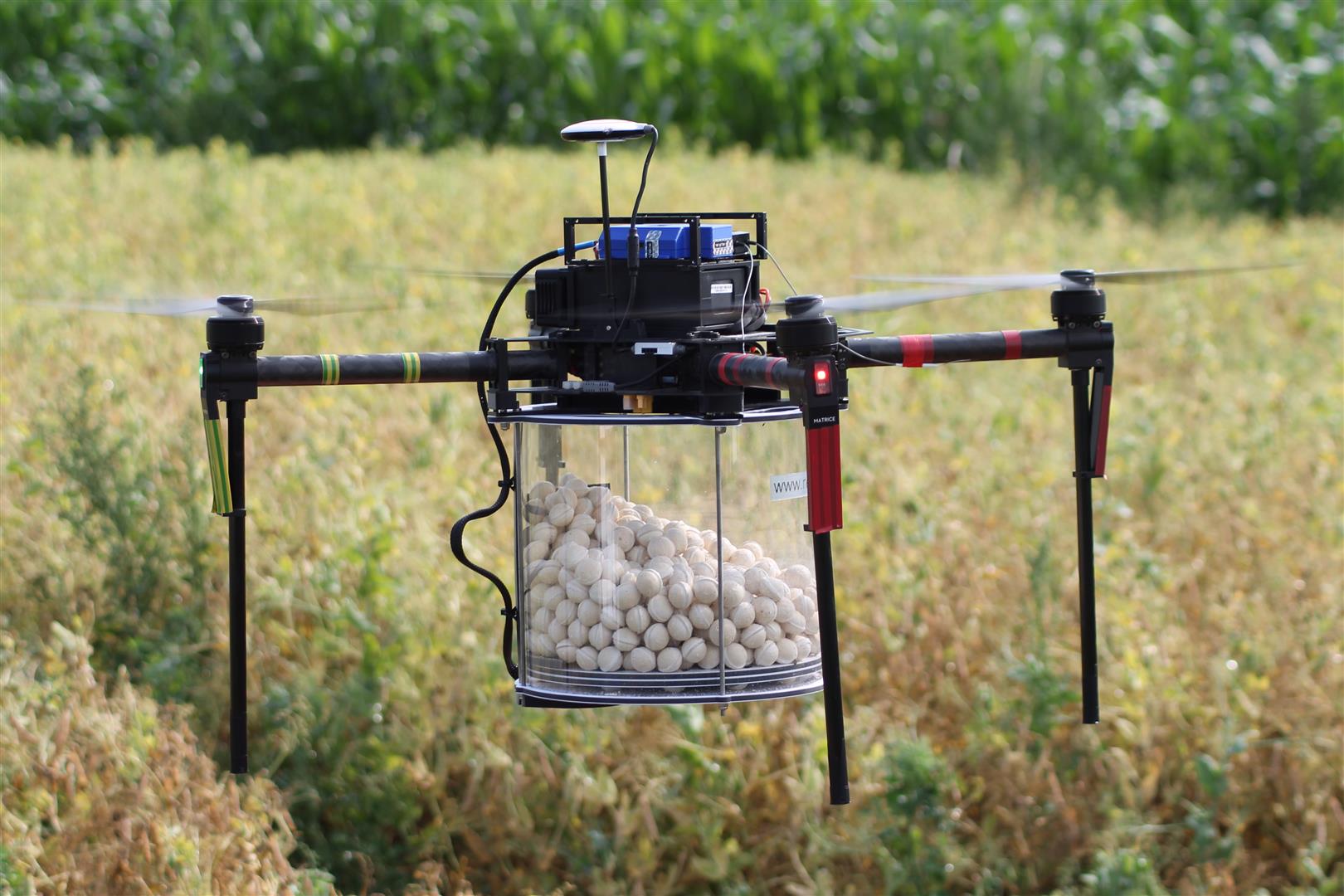
The experiment involved 26 farms: large, medium and small ones. Farms cooperating with Wielkopolska Agriculture Advisory Centre as demonstration network farms. In the experiment, we completed 119 tests and validations.
The innovation experiment involved a team composed of system analysts, business analysts, economists, programmers and testers. An essential factor of the experiment was the involvement of final users of the targeted services.
The most important challenges were:
1.- Enable high tech drone services for mass use, especially for small and medium farms
2.- Implementation and dissemination of online tools for close cooperation between farmers, advisory and ICT providers
3.- Combine drone mapping with complex agriculture advisory
4.- Determination of financial challenges, the cost-effectiveness of e-services and accessibility for a mass audience
5.- Adequate understanding of the needs of the users in the aspect of the availability of services at the level of medium and small farms
Biological treatment services
A comprehensive service that includes monitoring the presence of cornflower in corn cultivation, which provides for activities such as exposure and observation of light and pheromone traps, and determination of the optimal date of biological treatment (s). Treatments are made with the use of modern drones. Service also includes determination of effectiveness and advice on future protection plantation. This method is used to combat the eggs of the cornflower.
Field mapping
It is a service consisting in generating a field map based on photos taken from a drone using a multispectral camera. Based on the map, areas with a lower vegetative potential are determined, and site inspection and soil tests are performed. The result of the service is recommendations and advice on agricultural cultivation, fertilisation, plant protection and other aspects that may improve the conditions of plant vegetation and increase the yield, which is supported by a thorough analysis of the collected data.
Loss estimation
The purpose of the service is to determine the level of losses in crops or other agricultural land resulting from the activity of game animals (the so-called hunting damage), as well as the result of unfavourable weather conditions. It includes taking NDVI and RGB images using specialized cameras and their interpretation by a specialist. The effect of this is the calculation of losses using objective electronic tools, along with a description of the condition of the crop/use. The final material will be a protocol and graphic material (photos on an electronic medium).
Thermal imaging
The purpose of the service is to determine the level of energy loss in heated production buildings. 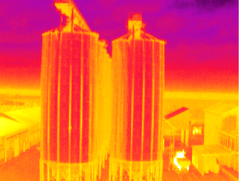 It includes taking infrared photos. The high lifting capacity of the drone allows for a wide range of applications, including a measuring thermal imaging camera and communication equipment, allowing for real-time image transmission to the operator on the ground. Using the software provided by the manufacturer, it is possible to further accurately analyze the collected material, including reading the temperature of each pixel in the image at a resolution of 640x480. The result is an indication of the places where energy losses occur, along with a description of the condition of the building. The final material will be a protocol and graphic material (photos on an electronic medium).
All of these services are available on a web portal for farmers in Wielkopolska region of Poland.
Partners:
1.- Wielkopolska Agricultural Advisory Center in Poznań – public advisory - experiment 16 coordinator, responsible for the service design, contacts with farmers and field tests, and the application for advisers.
2.- Cybernetic Technologies NETICTECH S.A. – SME - technological partner in experiment. Responsible for ICT and IoT technologies, drone flights and applications for farmers.